Thinking about buying mountain land in Murphy, NC, but not sure how to tell a great lot from a costly headache? You are not alone. Mountain parcels can look beautiful and still hide issues with access, septic, or buildability. In this guide, you will learn a simple, step-by-step way to evaluate land in Cherokee County using local tools and offices, plus what to verify before you write an offer. Let’s dive in.
What makes Murphy land different
Many rural areas of Cherokee County sit outside town limits, so there is often no countywide zoning. That means your main limits may come from recorded deed restrictions, HOA documents, floodplain rules, and state septic and well requirements. The county also includes large tracts of public land, which can shape access and nearby land use. Building permits usually depend on approvals for septic or public water and sewer, so you will coordinate with Environmental Health before permits move forward.
Read the land: topography and buildability
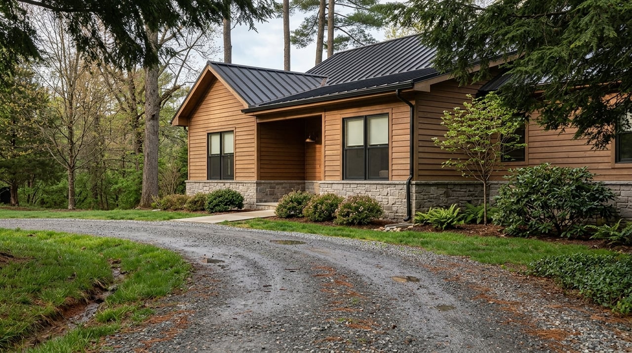
Topography drives almost every decision on a mountain lot. Slope, ridgelines, and hollows affect where you can place a driveway, foundation, septic field, and well. Start by pulling contours, aerials, and parcel lines in the Cherokee County Interactive Map. If slopes look steep or bedrock appears near the surface, plan for a topographic survey and consider a geotechnical review before design.
Confirm access: roads and easements
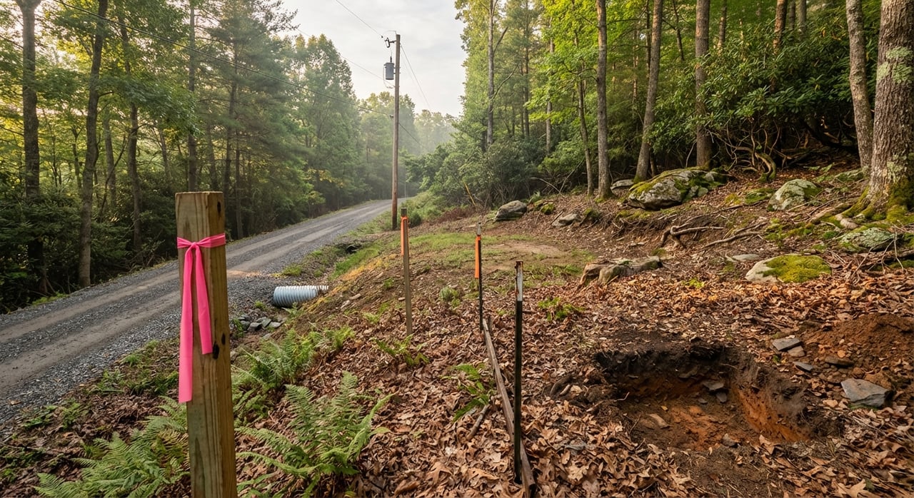
Do not assume the visible road is legal access. Confirm if the road is public or private, and whether your lot has deeded or platted access. Use the county parcel viewer for a first pass, then pull recorded deeds, plats, easements, and road maintenance agreements from the Cherokee County Register of Deeds. If your driveway will connect to a state-maintained road, a driveway connection permit may be required.
Verify utilities and connectivity
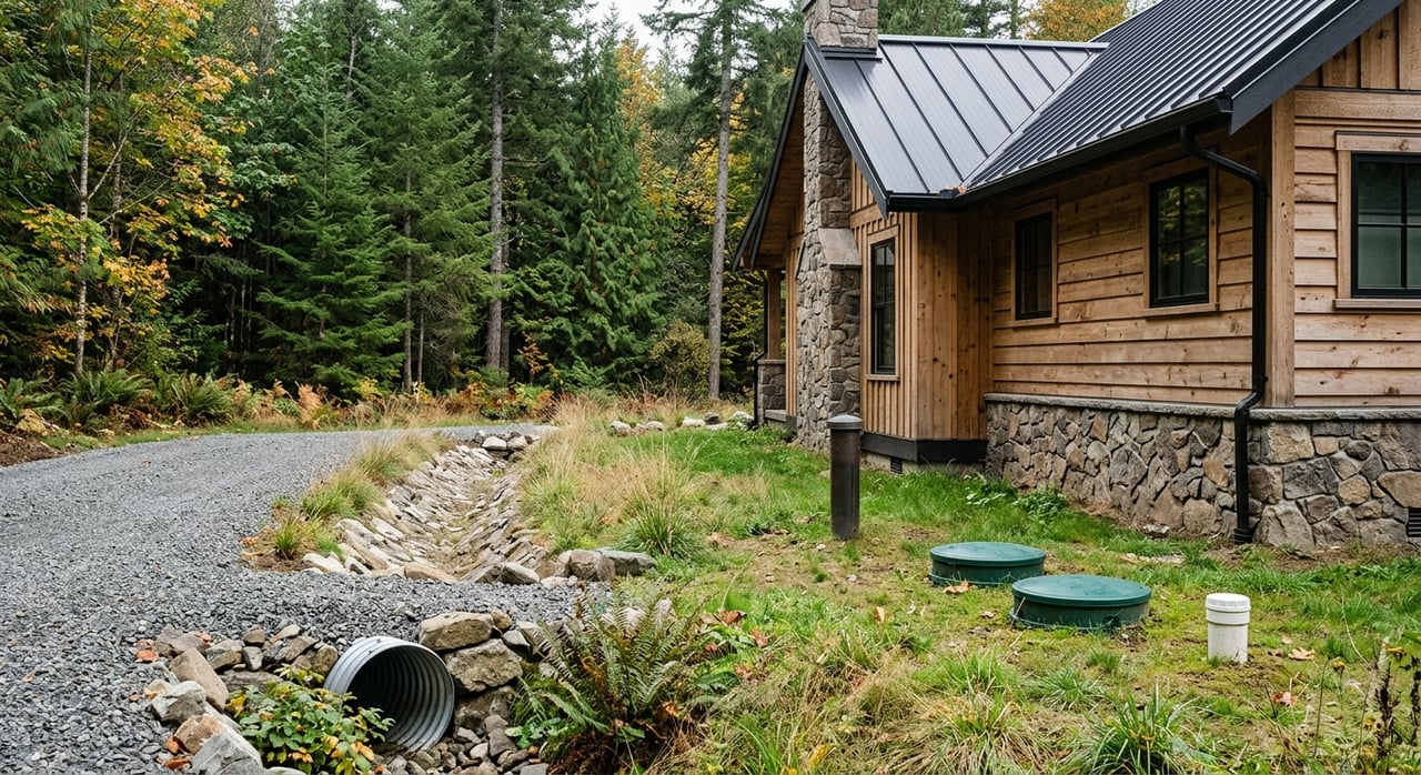
Power and fiber are location dependent in the mountains. For many Murphy-area roads, start with Blue Ridge Mountain EMC’s availability tool to check electric and fiber service near your parcel. Public water and sewer are generally limited to town or service-district areas. If you plan to connect to public systems, the county requires written approval from the town or service district, noted on the Residential permitting page. If not on public systems, plan for a private well and an onsite septic system.
Test soils, septic, and wells
Soils change quickly on mountain slopes. Run a quick screen in the USDA NRCS Web Soil Survey to map soils on your lot. Then contact Cherokee County Environmental Health to request a site evaluation for septic or to pull any existing records. If your parcel needs a private well, use the NC DEQ Well Permit Decision Tool to scan for potential contamination sources nearby and ask Environmental Health about local well logs and testing.
Check floodplains, wetlands, and streams
Always confirm flood risk on low-lying or river-adjacent land. Search the FEMA Flood Map Service Center for your parcel to see if any portion falls within a regulated flood zone. For wetlands and wet areas, review the USFWS National Wetlands Inventory as an initial screen. If maps show possible wetlands or your site is consistently saturated, budget time and cost for a professional delineation and any required permits.
Title and restrictions you cannot see on a walk-through
Some of the most important details live in the deed, not on the land. Search recorded deeds, plats, covenants, and maintenance agreements in the Register of Deeds. Look for road easements, shared driveways, CCRs, and any reservations like mineral rights or conservation easements. If there is an HOA, confirm annual fees, road responsibilities, and design guidelines.
Step-by-step due-diligence checklist
Use this practical order to reduce surprises and keep your timeline on track.
- Same-day online screens
- Pull parcel lines, contours, and aerials in the county GIS viewer.
- Check flood zones at the FEMA Flood Map Service Center.
- Map soils in the USDA NRCS Web Soil Survey.
- Scan wetlands in the USFWS Wetlands Inventory.
- Public-record checks within 72 hours
- Pull deeds, plats, easements, CCRs, and road agreements from the Register of Deeds.
- Confirm tax and assessor details in the county GIS viewer.
- Call the county offices
- Environmental Health: septic and well records or to request a site evaluation (Environmental Health).
- Permitting: ask about floodplain, erosion control, and public water or sewer approval needs, noted on the Residential permitting page.
- On-the-ground verification
- Boundary and topo survey by a licensed NC surveyor.
- Formal septic site evaluation through Environmental Health; budget for engineered systems if soils are shallow or slopes are steep.
- Well testing or drilling estimates; screen location with the NC DEQ tool.
- Geotechnical review for steep or rocky sites and to inform foundation design.
- Title and closing phase
- Order a title commitment; have a title professional review for easements, restrictions, and any reservations.
- Put key findings in writing as contingencies, including access, septic, well, survey, and permits.
Budgeting for mountain land costs
Budget beyond the purchase price. Driveway construction on slopes, clearing, and earthwork can be significant. Extending power or fiber from the nearest pole, drilling a deeper well, or installing an engineered septic system can also add cost. A survey, geotechnical review, and professional septic design are smart planning expenses that reduce risk.
Common pitfalls to avoid
- Assuming “no county zoning” means no rules. Private covenants, floodplain and watershed rules, and septic standards still apply.
- Waiting to check septic or well feasibility. Site evaluations and well testing drive both cost and design.
- Skipping legal access verification. An unrecorded driveway agreement can delay or block development.
- Overlooking utility reach. Service lines often stop at the nearest pole or meter, and extension costs vary by site.
How we help you buy with confidence
Buying mountain land is about more than a view. You need clear answers on access, buildability, and costs. Our team helps you screen parcels with county GIS, coordinate Environmental Health site evaluations, connect with local surveyors and well drillers, and confirm recorded easements and CCRs at the Register of Deeds. We guide you from first look to closing with a practical plan and local expertise.
Ready to find the right lot and move forward with confidence? Connect with the Donna Srabian Team for local guidance, instant listing alerts, and a free market report. We will help you evaluate land the right way, start to finish.
FAQs
How do I check legal road access for a Murphy land parcel?
- Review the parcel in the county GIS viewer for visible road frontage, then pull deeds, plats, and recorded easements at the Register of Deeds. Look for road maintenance agreements and drive connection requirements to public roads.
What permits do I need before building on mountain land in Cherokee County?
- Expect building permits to require approvals from Environmental Health for septic and wells or written approval for public water and sewer. Ask permitting staff about floodplain and erosion control requirements early.
How can I tell if a lot will support a septic system?
- Use Web Soil Survey for a quick screen, then request a site evaluation through Environmental Health. If soils are shallow or slopes are steep, plan for an engineered system and get estimates before you finalize price.
Where do I check flood risk for land near Murphy, NC?
- Search your parcel at the FEMA Flood Map Service Center to see if any part lies in a regulated flood zone. Compare results with county GIS layers and walk the site for signs of low or saturated ground.
Who provides power and internet to rural parcels around Murphy?
- Many roads are served by the local electric cooperative that also deploys fiber in parts of the county. Start with the provider’s availability tool, then call to confirm pole locations, extension costs, and installation timelines.